Nor'easter forecast off US East Coast, with possible subtropical development
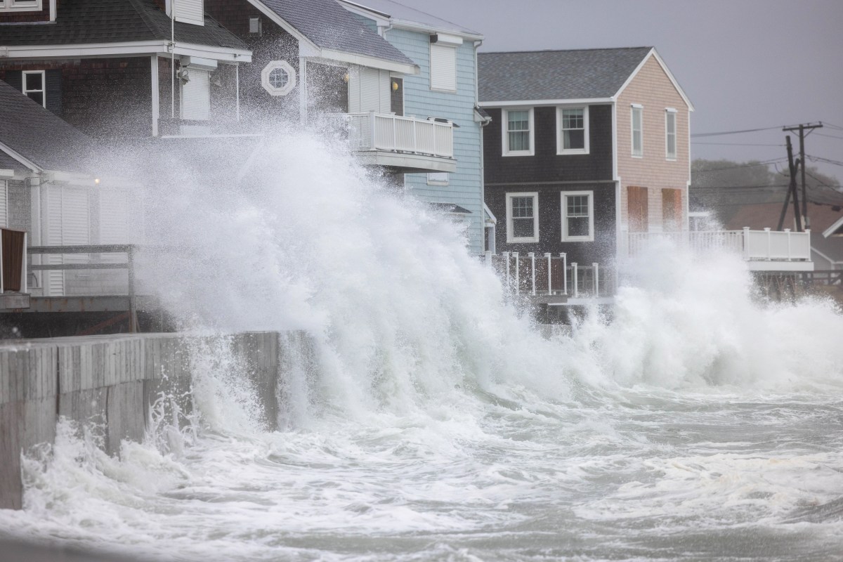
Forecasters expect a slow-moving nor'easter off the US East Coast in the week of 19 October, bringing coastal flooding and rough surf. It may take on subtropical or tropical features, though that chance was described as low.

1 / 2
The story, neutrally told
Mixed · 2Forecast models suggest a strong coastal low could develop off the US East Coast around 19–20 October and linger offshore for several days, bringing high winds, coastal flooding and dangerous surf. Daily MailR “The European forecast model suggests a storm could develop off North Carolina around October 19 to 20” Read at Daily Mail ↗ NewsweekN “Regardless of development, this system will cause high winds, coastal flooding, and dangerous surf along portions of the U.S. East Coast.” Read at Newsweek ↗ Right · 1The Daily Mail, reporting on 15 October, said a cold front was forecast to push toward the Atlantic by Saturday morning. If it stalled near the Southeast coast, a storm could form over the Gulf Stream and draw heat and moisture from its warm waters. Daily MailR “If that front stalls near the Southeast coast, a storm could form offshore and linger over the Gulf Stream, drawing heat and moisture from its warm waters.” Read at Daily Mail ↗ Right · 1That could give the system tropical characteristics, making it a hybrid of a nor'easter and a tropical cyclone. The Daily Mail said any tropical or subtropical development would most likely come between 19 and 22 October, and that the chance remained low. Daily MailR “Any tropical or subtropical development would most likely occur between October 19 and October 22, although the chance remains low.” Read at Daily Mail ↗
Centre · 1By Newsweek's report on 18 October, the National Hurricane Center said a strong non-tropical low was expected to form within a day or two. It said the low would move slowly and erratically through the middle of the following week, and that some subtropical development was possible. NewsweekN “A strong non-tropical low pressure area is expected to form during the next day or two off of the eastern coast of the U.S.” Read at Newsweek ↗ Right · 1The Daily Mail said the European model showed the system strengthening offshore by 23–24 October, with central pressure falling from 990 to 984 millibars. It noted that these numbers alone do not establish how strong the winds would become. Models from Google DeepMind and Germany's weather service showed similar scenarios. Daily MailR “Its central pressure falls from 990 to 984 millibars, a sign of intensification, although those numbers alone do not establish how strong its winds would become.”“Forecast models from Google DeepMind and Germany's weather service have shown similar scenarios.” Read at Daily Mail ↗ Right · 1Meteorologist David Tolleris compared the setup to the 1991 'Perfect Storm', saying 'it looks like the atmosphere is trying to do something like that again.' Meteorologist Ryan Maue wrote that a cut-off low could find enough warm water to become a subtropical or tropical storm and 'stay out to sea'. Daily MailR “it looks like the atmosphere is trying to do something like that again.”“could find enough warm water to develop into a Subtropical / Tropical Storm — and stay out to sea.” Read at Daily Mail ↗
Centre · 1Expected impacts depend on how close the storm tracks to shore. AccuWeather's Carl Erickson said wind gusts could reach up to 60 mph along parts of the mid-Atlantic coast. He said the most significant impacts were expected from southeastern Virginia into the Outer Banks, and that flooding could last over multiple high tides. NewsweekN “wind gusts could reach up to 60 mph along parts of the mid-Atlantic coast”“coastal communities could experience flooding over multiple high tide cycles” Read at Newsweek ↗ Mixed · 2AccuWeather expected strong coastal winds from North Carolina to southern New Jersey through Tuesday, with coastal flooding and beach erosion possibly lasting through Thursday. The Daily Mail reported surf of 12–25 feet offshore and heavy beach erosion expected along Florida's east coast. NewsweekN “Strong coastal winds are expected from North Carolina to southern New Jersey through Tuesday, and coastal flooding and beach erosion could continue through Thursday.” Read at Newsweek ↗ Daily MailR “Offshore waters 12-25 feet, breaking waves 10' or so into Daytona Beach.” Read at Daily Mail ↗ Centre · 1The National Weather Service issued storm and gale warnings. On Friday, a state of emergency was declared for Hatteras Island, North Carolina, and visitors were ordered to evacuate because Highway 12 was expected to become impassable. NewsweekN “On Friday, a state of emergency was issued for Hatteras Island in North Carolina, and visitors were ordered to evacuate before the storm arrived” Read at Newsweek ↗
Centre · 1Newsweek placed the storm in a wider context. A similar nor'easter hit the East Coast in late September, and the Atlantic hurricane season has been below average, with nine named storms so far, largely because of a strengthening El Niño. NewsweekN “So far, the Atlantic hurricane season has seen below-average activity this year, due largely to the strengthening El Niño in the Pacific Ocean.”“Nine named storms have formed so far this year” Read at Newsweek ↗ Centre · 1El Niño can suppress hurricanes through wind shear but can contribute to more nor'easters in winter. An NWS meteorologist said it was unclear how much role it played in the current storm, and Erickson said it was too early to say whether nor'easters would outnumber tropical impacts before the season ends on 30 November. The NWS Climate Prediction Center forecasts a strong-to-very strong El Niño through January–March 2027. NewsweekN “it's unclear how much of a role if any the climate pattern has played in the formation of the current nor'easter”“A strong-to-very strong El Niño is likely through January to March 2027” Read at Newsweek ↗
Every sentence links to the reporting it rests on. The pill in front of each says where its sources sit: Left, Centre or Right when one side supplies at least half of them, Mixed when they are evenly split. The number is how many outlets it cites.
Left0 outlets
No left outlet in our sources has covered this story yet.
Centre1 outlet
- Framing
- Newsweek treats the storm as a current event with warnings in force, then links it to El Niño and the quiet hurricane season, asking whether nor'easters are the bigger threat.
- Emphasis
- Official warnings, the Hatteras Island emergency, expert quotes from AccuWeather and the NWS, and explainers on nor'easters versus hurricanes.
- Leaves out or plays down
- Does not mention the 1991 'Perfect Storm' comparison or the individual model runs (European, DeepMind, German).
- Charged language
- “battered the East Coast”
- For example
-
“As a new nor'easter takes shape in the Atlantic, meteorologists are warning that the widespread impacts associated with such coastal storms could pose a greater threat” — Newsweek
Right1 outlet
- Framing
- The Daily Mail leads with the possibility of a rare hybrid storm and the 'Perfect Storm' comparison, based on forecast models days before any storm formed.
- Emphasis
- Model output, the 1991 'Perfect Storm' and the Andrea Gail tragedy, and the uncertainty over whether the storm would become tropical.
- Leaves out or plays down
- Written earlier (15 October), so it has no emergency declarations or NHC warnings. It also does not mention El Niño or the late-September nor'easter.
- Charged language
- “Millions could face powerful hybrid cyclone”“pounding surf”
- For example
-
“A powerful hybrid of a nor'easter and a tropical storm could form off the East Coast, in a setup meteorologists compared to the 1991 'Perfect Storm.'” — Daily Mail
What every side reports
- A storm was forecast to develop off the US East Coast around 19–20 October.
- It could develop subtropical or hybrid features, but both outlets stress the uncertainty.
- Both outlets say coastal flooding, rough surf and beach erosion are expected, whatever the storm becomes.
- Both cite AccuWeather forecasters.
Where accounts differ
-
How likely tropical development is
- Centre
- Newsweek quoted the NHC saying some subtropical development was possible, and focused on the coastal impacts whatever the storm becomes.
- Right
- The Daily Mail said any tropical or subtropical development was low-chance and framed it through the Perfect Storm comparison.
Left0 articles
No coverage yet.
Centre1 article
-
El Niño Could Leave the East Coast Facing Bigger Threat Than Hurricanes
Neutral Explanatory piece quoting forecasters and agencies, linking the current nor'easter to El Niño and a below-average hurricane season.
Right1 article
-
Millions could face powerful hybrid cyclone off East Coast in just days, forecast models suggest
Alarmist Speculative, model-driven preview that stresses a possible hybrid storm and the Perfect Storm comparison, while noting that the chance of development is low.
- 15 Oct 21:16 First Daily MailR Millions could face powerful hybrid cyclone off East Coast in just days, forecast models suggest
- 18 Oct 00:29 +51h 13m NewsweekN El Niño Could Leave the East Coast Facing Bigger Threat Than Hurricanes
Times are when each article was published, or when we first saw it if the outlet gave no time.
Ask about this story
Loading…