Two new islands emerge near Anak Krakatoa after 25-hour September eruption
Indonesia's geological agency says two island-like formations have appeared off Anak Krakatoa after a 25-hour eruption in September. Their origin and composition are unconfirmed.
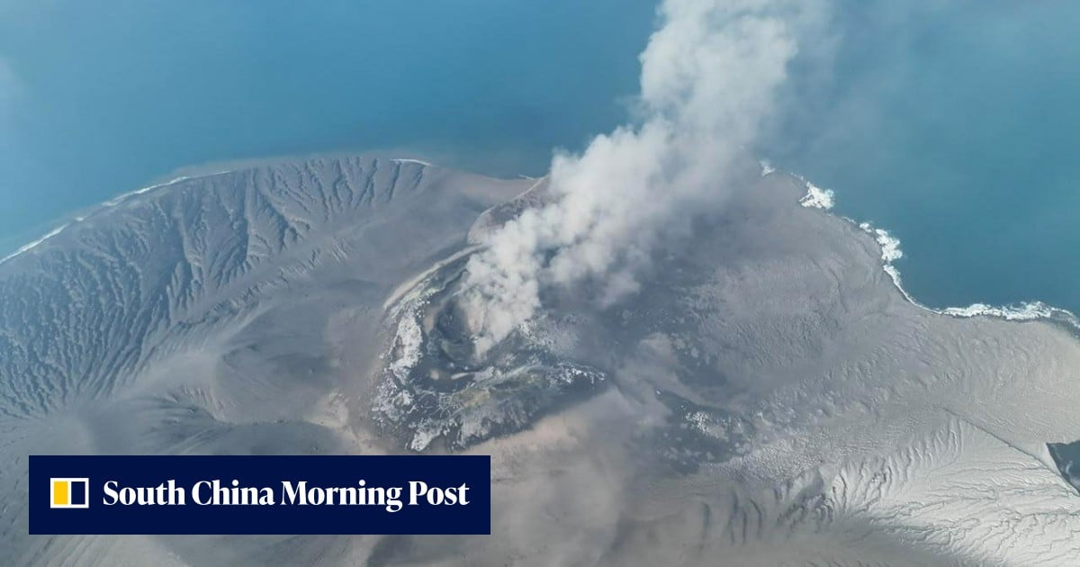

1 / 2
The story, neutrally told
Two new island-like formations have appeared off Anak Krakatoa, in the Sunda Strait between Java and Sumatra, following a 25-hour continuous eruption in September. South China Morning PostN “Two new islands have appeared off Anak Krakatoa, potentially the first in nearly a century to emerge within the caldera” Read at South China Morning Post ↗ The HinduLC “Mount Anak Krakatau erupted for 25 hours non-stop in September” Read at The Hindu ↗ Indonesia's geological agency places one formation about 760 metres off the volcano's northwest coast and the other about 495 metres away. Bloomberg, carried by the South China Morning Post, puts the second to the southeast, while The Hindu, citing AFP, says southwest. South China Morning PostN “The agency places one about 760 metres (0.5 miles) off Anak Krakatoa’s northwest coast and the other some 495 metres to the southeast.” Read at South China Morning Post ↗ The HinduLC “One of the islands was located about 760 metres northwest of Mount Anak Krakatau, the other about 495 metres southwest.” Read at The Hindu ↗ The formations are visible in Sentinel satellite imagery, a European Space Agency satellite fleet. The agency said it had also received reports from mariners and volunteers who sailed through the area, and it has not verified their size or height above sea level. The HinduLC “Sentinel is a fleet of Earth observation spacecraft developed by the European Space Agency.” Read at The Hindu ↗ South China Morning PostN “It has not verified their dimensions or elevation above sea level.” Read at South China Morning Post ↗
A volunteer's drone footage, shot nearly two weeks after the eruption during a search for missing journalists, appears to show the northwestern formation, with waves breaking over a low, dark mass. South China Morning PostN “The footage appears to show the new northwestern island.” Read at South China Morning Post ↗ Officials say the origin is unresolved. The agency's preliminary interpretation is that relatively fluid magma rose through an elongated northwest-southeast opening and built two offshore mounds. Its volcano team head, Heruningtyas Desi Purnamasari, said satellite imagery alone cannot confirm whether material erupted there or whether the features are new vents. South China Morning PostN “we cannot yet confirm whether volcanic material was directly erupted at these locations or whether they represent new eruptive vents.” Read at South China Morning Post ↗ The HinduLC “further research was needed to determine if the new islands were emerging from the base of the caldera” Read at The Hindu ↗ University of Indonesia geoscientist Asri Oktavioni Indraswari said that if they are new vents, activity would no longer be confined to Anak Krakatoa's central conduit. South China Morning PostN “that would mean activity is no longer confined to Anak Krakatoa’s central conduit.” Read at South China Morning Post ↗
Their survival is uncertain. Anak Krakatoa's own history shows landmasses that emerged from 1927, then eroded away, before a lasting island formed in 1930. The new islands may erode similarly. The HinduLC “The two new islands may similarly be eroded away over time.” Read at The Hindu ↗ South China Morning PostN “The sequence repeated until the island was finally established in 1930.” Read at South China Morning Post ↗ The September eruption added nearly 33 hectares to Anak Krakatoa, blanketed cities in ash and closed several airports. The Hindu reports more than 300,000 passengers were stranded. South China Morning PostN “adding nearly 33 hectares (81 acres) to the island’s area” Read at South China Morning Post ↗ The HinduLC “More than 300,000 passengers were left stranded.” Read at The Hindu ↗ The volcano is at alert Level 2 of 4, and people are advised to stay at least three kilometres from the eruption centre. Five journalists and three boat crew who went to cover the eruption were declared presumed dead after their vessel vanished. The HinduLC “Anak Krakatau was at alert Level 2, the second lowest out of four danger categories.”“Five journalists on a mission to cover the September eruption were declared presumed dead with three boat crew” Read at The Hindu ↗
Every sentence links to the reporting it rests on.
Left1 outlet
- Framing
- Agency announcement carried from AFP: the islands were spotted in satellite images, set against the eruption's disruption.
- Emphasis
- Flight cancellations, more than 300,000 stranded passengers, the alert level and exclusion zone, and the presumed-dead journalists.
- Leaves out or plays down
- Omits the drone footage and outside expert comment, and gives no estimate of the area added to the island.
- Charged language
- “blanketing cities in volcanic ash”
- For example
-
“Two new islands have emerged in the waters surrounding Mount Anak Krakatau following a major eruption last month that grounded flights for days” — The Hindu
Centre1 outlet
- Framing
- Geological-history angle: the islands may be the first in nearly a century to emerge in the 1883 caldera.
- Emphasis
- Scientific uncertainty, the volunteer drone footage, expert comment from Indonesian and British academics, and the history of Anak Krakatoa's formation.
- Leaves out or plays down
- Says little about the airport closures, stranded passengers or alert level.
- Charged language
- “catastrophic 1883 eruption”
- For example
-
“potentially the first in nearly a century to emerge within the caldera left by Krakatoa’s catastrophic 1883 eruption” — South China Morning Post
Right0 outlets
No right outlet in our sources has covered this story yet.
What every side reports
- Two island-like formations appeared about 760 m and 495 m from Anak Krakatoa after a 25-hour September eruption.
- They are visible in Sentinel satellite imagery.
- Their origin (new vents or piled-up eruption deposits) is not yet confirmed.
- Earlier landmasses at Anak Krakatoa emerged from 1927 and eroded before a lasting island formed in 1930.
Where accounts differ
-
Direction of the second formation from Anak Krakatoa
- Left
- The Hindu (citing AFP): about 495 metres southwest.
- Centre
- Bloomberg (SCMP): about 495 metres to the southeast, roughly in line with the first through the crater.
-
Who at the agency announced it
- Left
- Names Rita Susilawati of PVMBG as head of the agency.
- Centre
- Names Heruningtyas Desi Purnamasari, who heads a volcano team at the Geological Agency.
Anak Krakatoa place
The volcano is at alert Level 2, and the formations may be eroded away over time.
“Anak Krakatau was at alert Level 2, the second lowest out of four danger categories.” — The Hindu
Indonesia place
Indonesian agency officials say the formations are real but their origin needs more study.
“At this stage, we cannot confirm the origin or composition of the two features based on satellite imagery alone” — South China Morning Post
Left1 article
-
New islands appear after Indonesia's Anak Krakatau volcano erupts
Neutral Short agency-sourced report pairing the discovery with the eruption's human and travel impact.
Centre1 article
-
South China Morning PostN · · via Bloomberg
2 new islands appear near Indonesia’s Anak Krakatoa volcano after eruption
Neutral Detailed Bloomberg explainer on the formations' scientific significance and uncertainty.
Right0 articles
No coverage yet.
- 2 Oct 02:52 First South China Morning PostN 2 new islands appear near Indonesia’s Anak Krakatoa volcano after eruption via Bloomberg
- 2 Oct 09:31 +6h 38m The HinduLC New islands appear after Indonesia's Anak Krakatau volcano erupts
Times are when each article was published, or when we first saw it if the outlet gave no time.